Forest Carbon’s Sumatra Merang Peatland Project is now a proven model for large-scale forest restoration. With project partner Global Alam Lestari, teams on the ground are actively managing more than 22,000 hectares of vulnerable peatland to reduce the risk of forest fire, strengthen the rural economy, and protect habitat for the Sumatran Tiger. Project Impacts Include:
Indonesia’s peatlands are among the most vulnerable ecosystems on earth, and also significant carbon sinks. The project is protecting one of these key peatland areas, part of a larger peat swamp forest zone linked to Sembilang National Park in the east, Muaro Jambi peat swamp forest in the north and Berbak national park in the northwest.
The project was launched to restore the area after a massive forest fire in 2015 destroyed thousands of hectares of biodiverse tropical forest. Fire risk to these peatland areas is high, due to canals that were dug for logging and plantation development. These canals, once used to transport timber from illegal logging operations, have dried out once-lush swamp forest areas, making them highly prone to fire.
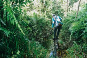
Forest Patrollers in the project are actively fighting fires in the wider landscape to protect the area from continued fire damage. Teams are also focused on long-term efforts to rehabilitate the area by blocking man-made canals to restore the natural water table levels on the site. By early 2020, project engineering teams had constructed more than 180 peatland compaction dams, which have had a dramatic effect. Project peatland areas are now inundated with water, which enables the habitat to effectively regenerate on its own while significantly reducing the risk of fire.

Legacy systems to demonstrate project impact and monitor large-scale wetland areas require daily measurements by hand to monitor water levels, rainfall and other fire risk indicators. As the area regenerates, parts of the forest are becoming increasingly hard to access. Working with technology partner Sustainability Tech, Forest Carbon has deployed an array of sensors connected to long-range wifi using Internet of Things (IoT) protocols that relay data to a central dashboard.
By using advanced monitoring technology, Forest Carbon can track regeneration in real time across an area more than three times the size of Manhattan. Project teams and investors can monitor sensors from across the project from anywhere with an internet connection. The water table sensors deployed in the project are just one of many sensor types linked to an IoT sensor hub, which produces hourly and daily reports, providing instant assessment of fire risk and data on project hydrology management.

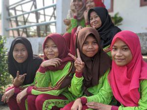
The most immediate benefit for neighboring communities has been direct and indirect employment for more than 40 local staff, in addition to education and job training opportunities. The project’s long-term community development program focuses on building deep relationships with surrounding villages, ensuring their interests are identified in a participatory process. This data-driven program has established partnerships with NGOs and local governments that allow initial efforts to be scaled up over the long term.
Current efforts include a focus on the expansion of health resources, including a renovation of the closest community health center, and hiring new staff to provide free services to the nearest community of more than 2,400 people. The project is also investing in education for students of all ages, from after-school programs for young children to an adult education program that is extended to community members and all project staff, reaching more than 120 students and teachers.

Forest Carbon’s Sumatra Merang Peatland Project is nurturing several important biodiversity corridors to connect habitat between remaining High Conservation Value (HCV) forest areas in the wider landscape. The largest nearby forest assets are the peat swamp forest areas in Sembilang National Park, which lies approximately 5km to the east.
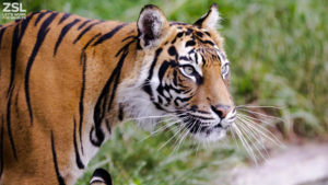
The project is a documented habitat for the Sumatran Tiger, of which fewer than 300 are left in the wild. In addition, the project’s biodiversity monitoring and camera trap program has recorded over 210 unique species of flora and fauna across the project site, which includes 31 species classified as Threatened, Endangered or Critically Endangered. This data is a baseline that will be used to track long-term trends and species occurrence over time in accordance with the project’s Gold Status for Biodiversity, under the Climate Community and Biodiversity Standard and attracted the support of partners like the Zoological Society of London. (Photo Credit ZSL).